
Utilities Windows
MapWindow GIS
View spatial data, connect to geodatabases and extend mapping tools with plug-ins in MapWindow5, the free, open-source Windows desktop GIS.
- Operating system
- Windows; exact supported versions not established by the selected publisher sources
- Architecture
- x64
- Download package
- EXE installer
Selected asset: MapWindow-v5.6.3.0-x64.exe. A separate Win32 installer is listed. No installation or current-Windows compatibility test performed.
Link checked · Download guidance
What is MapWindow GIS?
MapWindow GIS is a desktop geographic information system for working with spatial data. This entry covers MapWindow5, the desktop application, rather than MapWinGIS.ocx, the separate programming control it uses as its mapping engine. The desktop is a useful fit when you want a map workspace with plug-in extensions instead of embedding a mapping component in your own application.
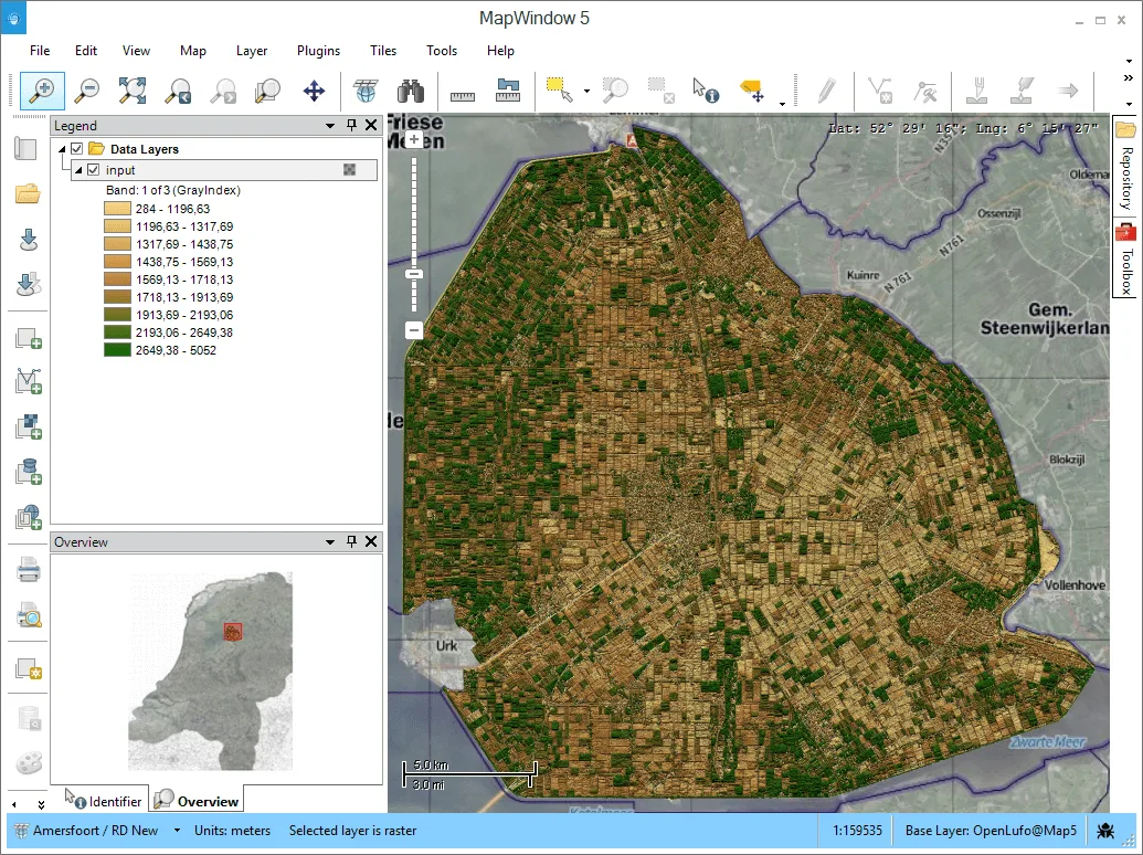
The publisher lists WMS support and connections to PostGIS, MS-SQL Spatial and SpatiaLite geodatabases. Its repository browser and toolbox organize additional work, including restartable tasks. The 5.6.3 release notes also identify a CAD-like snapping tool and a symbol-rotation plug-in.
The selected download is the publisher's MapWindow5 5.6.3 Windows x64 EXE installer; a separate Win32 installer is available. This is a historical release with installer assets dated July 31, 2020, not evidence of current Windows-version support or security maintenance. The publisher screenshot shows an older MapWindow5 interface, not a test of the selected installer.
What it offers
- Work with spatial data in a desktop GIS powered by the MapWinGIS mapping engine.
- Connect to PostGIS, MS-SQL Spatial and SpatiaLite geodatabases and use WMS sources.
- Extend the desktop with plug-ins and tools, including buffering or clipping tasks.
- Use the repository browser and toolbox with restartable tasks.
- The 5.6.3 release adds CAD-like snapping and a symbol-rotation plug-in.
Good to know
- The selected installer assets date to July 2020; compatibility with specific current Windows releases and ongoing security maintenance are not established by these sources.
- MapWinGIS.ocx is a programming control, not the MapWindow5 desktop application; the two projects have separate release downloads.
- The official site says MapWindow5 documentation is still under construction.
Product images
Sources
References used for this listing. Retrieval dates do not indicate hands-on testing.
More in utilities
View category ↗
1.1.1.1 with WARP 2026.8.2115.0
Encrypt traffic from your Mac to Cloudflare’s network with WARP, or use DNS-only mode for encrypted DNS queries to the 1.1.1.1 resolver.
1.1.1.1 with WARP 2026.8.2115.0
Encrypt traffic between your Windows PC and Cloudflare, or use encrypted DNS only, with the free 1.1.1.1 with WARP app.


3uTools 9.12.005
Manage iPhone and iPad photos, music, apps and backups from Windows with 3uTools, a free utility that also includes device checks and firmware flashing tools.