
Utilities Windows
QuikGrid
Turn scattered XYZ data into contour maps and 3D surface views with QuikGrid for Windows. This download is the publisher's legacy 5.4 installer.
- Operating system
- Microsoft Windows; current Windows release compatibility unverified
- Architecture
- Not established for the selected legacy installer
- Download package
- EXE installer (qgrid54.exe)
Publisher identifies this as the older 2009 release. Its legacy Windows Help facility is unsupported; online documentation is available.
Link checked · Download guidance
What is QuikGrid?
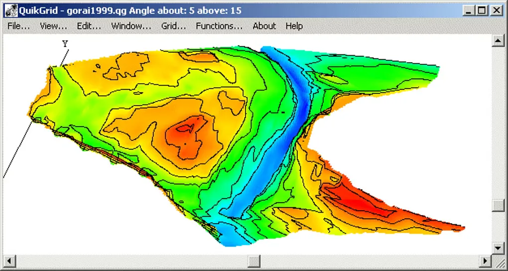
QuikGrid reads scattered points with x, y and z coordinates, generates a grid and displays the resulting surface as a contour map or a 3D view. It suits a first visual inspection of survey or terrain data when the measurements are available as individual points rather than an existing surface grid. Mouse controls let you zoom, pan and inspect grid coordinates and data points.
The display can use a wireframe or a hidden-surface grid with optional colours. For work in other tools, QuikGrid can export grid and contour lines as DXF, and export the generated grid as XYZ triplets, DXF 3DFACE or an ER Mapper Raster Dataset. It can also view 1-degree USGS DEM files.
The linked package is the original publisher-hosted 5.4 release from 2009, not a claim to the newest build. The publisher recommends Stephen Ferrell's later versions because Microsoft no longer supports the Windows Help facility used by this older release. The linked GitHub releases page returned 404 during this check, so this entry identifies the available legacy package explicitly. Online documentation remains linked from the publisher's availability page; compatibility with current Windows releases has not been verified.
What it offers
- Generate a surface grid from scattered XYZ measurements and view it as contours or a 3D representation.
- Switch between wireframe and hidden-surface displays, with optional colours.
- Zoom and pan with the mouse, and inspect grid coordinates and data points.
- Export DXF contour/grid lines or grid data as XYZ triplets, DXF 3DFACE and ER Mapper Raster Dataset; view 1-degree USGS DEM files.
Good to know
- This is the legacy 5.4 package from 2009. Its Windows Help facility is no longer supported by Microsoft; the publisher recommends later builds with reimplemented help.
- Compatibility with current Windows releases and the selected installer's CPU architecture have not been verified.
Product images
Sources
References used for this listing. Retrieval dates do not indicate hands-on testing.
More in utilities
View category ↗
1.1.1.1 with WARP 2026.8.2115.0
Encrypt traffic from your Mac to Cloudflare’s network with WARP, or use DNS-only mode for encrypted DNS queries to the 1.1.1.1 resolver.
1.1.1.1 with WARP 2026.8.2115.0
Encrypt traffic between your Windows PC and Cloudflare, or use encrypted DNS only, with the free 1.1.1.1 with WARP app.

3uTools 9.12.005
Manage iPhone and iPad photos, music, apps and backups from Windows with 3uTools, a free utility that also includes device checks and firmware flashing tools.